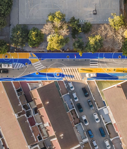
The work is divided into 2 parts: the first, a good definition of the area at an urban level; and the second, the execution of the connection networks between the new expansion proposal and the streets of Navas de Tolosa and Taconera in Pamplona. The two differentiations together create a completely new, connected, innovative, more natural and friendly urban area.
Description of project by Leku Studio
Within the framework of the SUMP of the Pamplona region, the city is moving towards a new sustainable urban model that leaves behind the reality in which the private vehicle has been the protagonist. This defines the roadmap for the construction of a new urban landscape that empowers citizens by promoting walking routes, overcoming accessibility problems, favoring the use of bicycles, promoting intermodality and the supply of public transport, and reducing the use of the private vehicle. Thus, a large area of public space is recovered with enormous potential to improve the quality of life of citizens. The I Ensanche redevelopment project draws and lays the foundations for a new urban landscape and ultimately a healthier, friendlier, and greener Pamplona.
The I Ensanche as an urban system that articulates and connects the Old Town with the Citadel and consequently with the southwest area of the city (Iturrama neighborhood, hospitals, universities ...) is a key element in the transformation process of the city. Until recently, the streets of Taconera, Navas de Tolosa, and its continuation through Yanguas and Miranda constituted a highway with an incessant flow of cars. This has created a barrier that hampered the transversal and sustainable connectivity of pedestrian and bicycle flows from the Old Town to the I Ensanche and the Citadel. Avenida Pio XII and Calle Bosquecillo had just formed a road belt that limited and separated the urban realities of the Old Town and the I Ensanche with negative implications not only at the level of mobility but also at the level of loss of interaction and creation of synergies through other levels: commercial, social, economic...
To promote and consolidate the change in the model of the I Ensanche, the project re-establishes priorities and redistributes the streets, recovering a large area of free spaces for pedestrians with the drastic reduction of car traffic both in the transition axes between the Casco Antiguo and I Ensanche as well as the internal roads of the latter. Along the same lines of action, a firm commitment is being made to promoting public transport with the location of new bus lines and central stops on the new axis located in the heart of the city.
The project is deployed based on 2 approximation scales: a first level that establishes the general framework throughout the I Ensanche defining the criteria and guidelines of the new urban model and a second level with its concrete application with the development of the redevelopment project of the new civic axis made up of Navas de Tolosa and Taconera streets. The action framework establishes 3 strategic lines of action for the redevelopment and modal change of the I Ensanche:
Connectivity
It is committed to decisively reinforcing connectivity and transversal accessibility using the I Ensanche as an articulating fabric between the Old Town and the Citadel.
Rehabiting the public space
Beyond the connectivity and mobility functionality of the streets, the proposal seeks to emphasize the need to inhabit the public space of the city, understanding the streets as civic spaces where citizens share, learn, know, meet, enjoy...
Renaturation of the I Ensanche
The objective of the proposal is to extend the green of the Citadel to the Old Town through the new green corridors of the I Ensanche that will expand and consolidate the ecological infrastructure of the city. The desire to re-naturalize the city responds to the benefits that vegetation provides by improving the water balance, regulating various environmental parameters such as pollution, temperature, noise...


