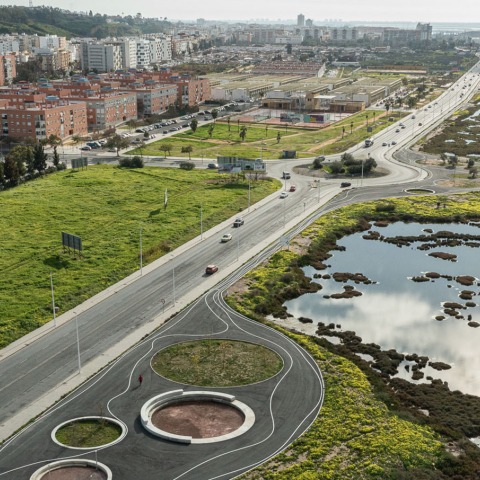
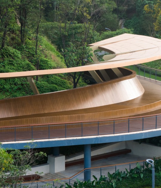
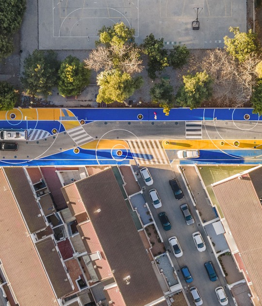
Based on the use of the rich natural and cultural heritage, it seeks to maintain its essence through organic forms and materials used historically in this territory. The project uses different traditional solutions that take us from mud walls or untreated wood, to water passages reinterpreted with honeycomb plates, or steel and perforated sheet metal that recall the area's rich mining-railway past.

Landscape itinerary around the northern Odiel estuary by Estudio ACTA. Photograph by Fernando Alda.
Project description by Estudio ACTA
The action is born from the consideration that the citizens of the 21st century no longer live in confined places - even if they reside there -, with hardly any relationship with the residents of other nearby municipalities. The concept of Territory, as a space where life develops – work, residence, leisure, social relationships – calls for the establishment of ties between the different parts that make up our physical reality, beyond the creation of new administrative entities.
We are facing a large green infrastructure of a supra-municipal nature, 30 km long. long, which connects the towns of Huelva, Aljaraque and Gibraleón - with about 180,000 inhabitants in total - and brings them closer to the great environmental, landscape, botanical, zoological and heritage wealth that encompasses the vast protected natural space of Marismas del Odiel that surrounds (7,200 hectares). The main objectives are non-motorized accessibility between the three aforementioned towns through a multimodal route that runs along the edge of the North Odiel estuary; and the requalification of degraded urban-rural edges, through environmental regeneration and improvement of their landscape image.

Landscape itinerary around the northern Odiel estuary by Estudio ACTA. Photograph by Fernando Alda.
The intervention is voluntarily contaminated by other disciplines beyond the purely architectural, already present in the work territory. And so, in addition to architecture, it is engineering (bridges), hydraulics (gates and sheet piles), infrastructure (roads and breakwaters), landscape (viewpoints), heritage (Tharsis dock-loading station), ethnography (tide mills and salt mines), botany. (25,000 new specimens planted), biology (sheets of water for bird stays), sport (piers for canoes and fishing) and even public health (promotion of non-motorized mobility).
The route runs along disused railway tracks, livestock trails, edges of marshes, old abandoned salt mines, and the occasional urban stretch. Just as any text needs punctuation marks to be legible, the itinerary is punctuated by a series of elements (pergolas, bridges, piers, rest areas, viewpoints or rooms) that, like architectural-sculptural proposals of territorial acupuncture and strategically located, they help to guide the route, mark the rhythms and make the territory legible.
The project continually oscillates between the large scale of the territory where the action takes place and the intervention itself (XXL) and the small scale of the architectural pieces built (XXS), with hardly any scale or average dimensions common in architecture appearing. Likewise, the meager budget managed for an intervention of this caliber has forced us to sharpen ingenuity and concentrate efforts on very specific points of the broad route.

Landscape itinerary around the northern Odiel estuary by Estudio ACTA. Photograph by Fernando Alda.
To define its morphology and choose the materials with which it is defined, the strategy involves remembering the rich natural and cultural heritage of the territory and maintaining its essences: the riverside, mining and railway character, and its conception of a great scenic viewpoint from the rural land. All of this is realized in the use of curved, natural, sinuous and organic shapes, the same ones that intertidal nature shows us. As for materials, we have resorted to those used historically in this territory: breakwaters, mud walls, gates, sheet piles, driving eucalyptus sticks, untreated wood that harmonizes with the environment, and water passages reinterpreted with honeycomb plates. The traces of the rich mining-railway past are reflected in the use of steel and perforated sheet metal with which bridges, pergolas or viewpoints are built, hybrids between architectures and sculptures stranded in the territory.
In summary, starting from an infrastructure and communications project, we propose to give added value to the intervention, until it becomes an equipped park. In short, it is about taking advantage of a 30 km operation loop tour, to reflect on the future and the development of the territory it surrounds.


