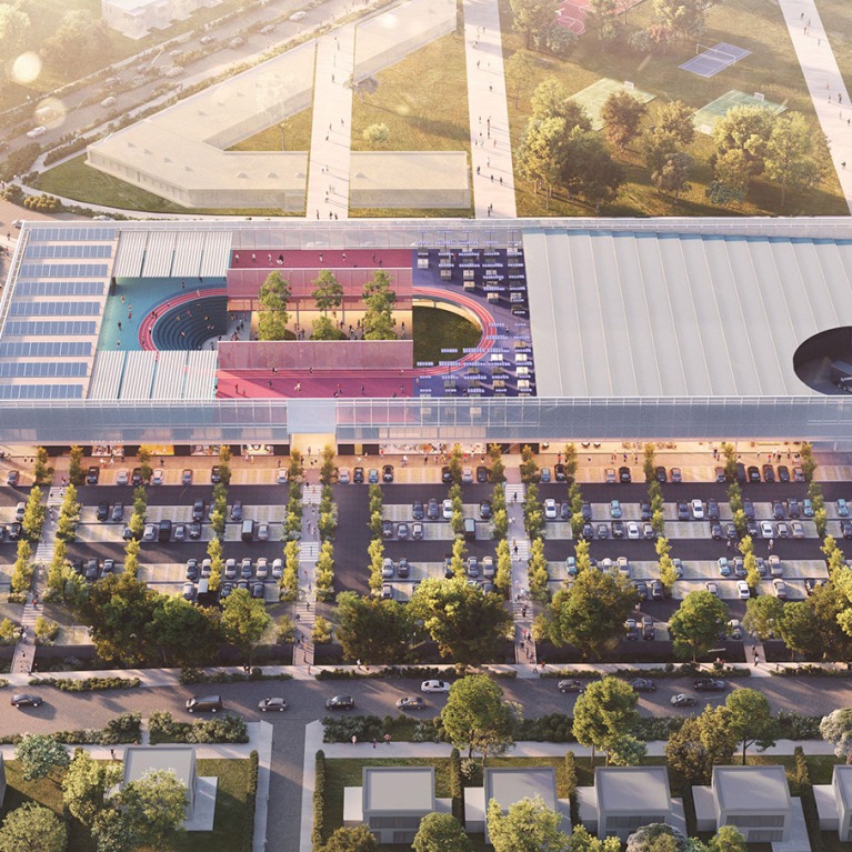
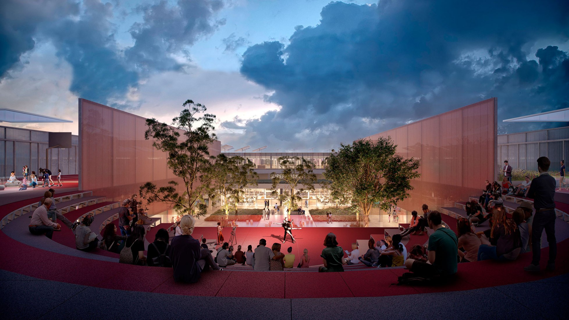
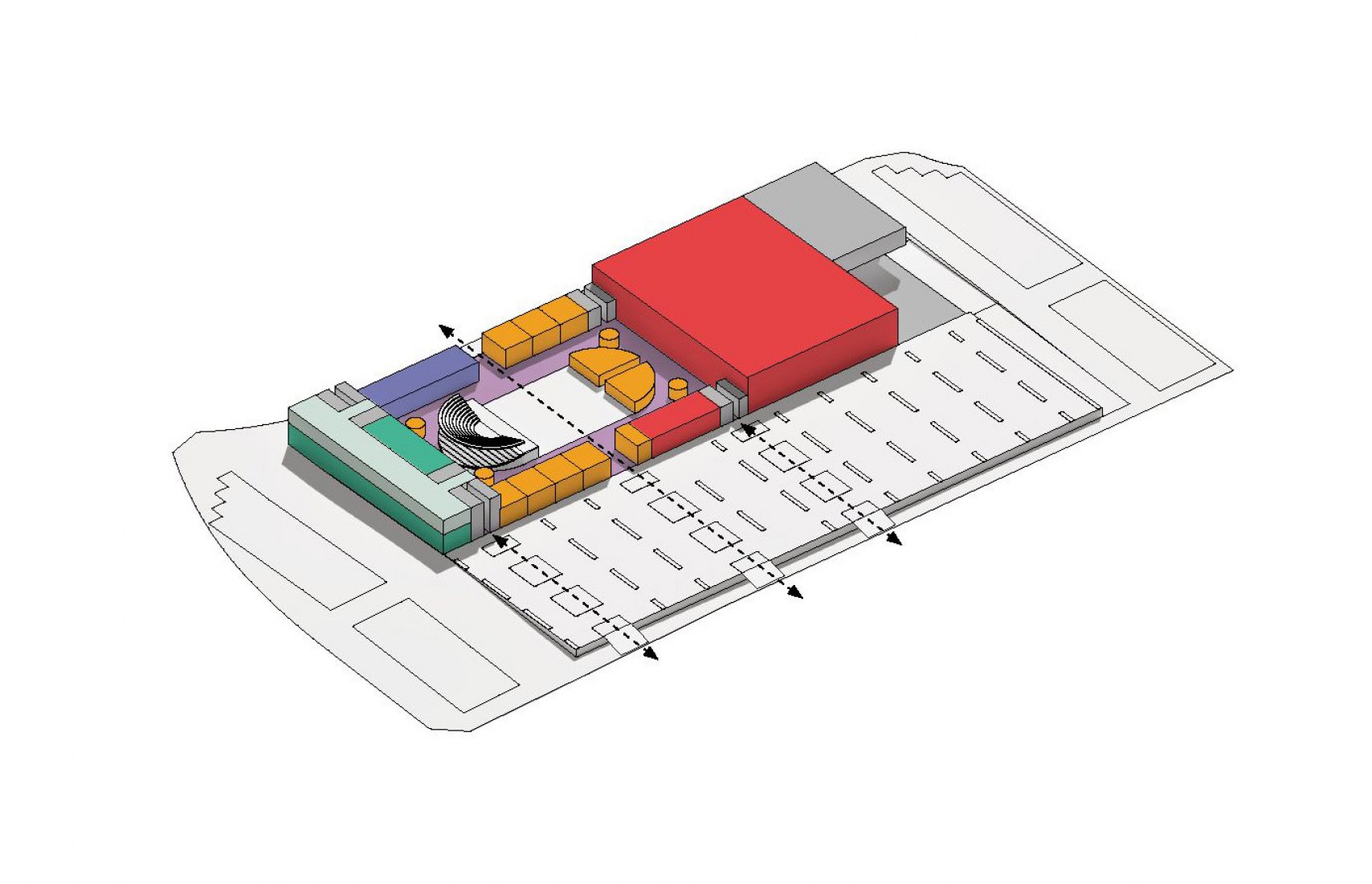
At the centre, a shaded courtyard with an amphitheater will be used for events and daily activities. An accessible roof offers extra areas for sports and education, and opens up possibilities for urban agriculture and energy saving initiatives.
"Las zonas espaciales organizadas en franjas verticales albergan otros espacios de servicios, instalaciones para niños y ofertas minoristas centradas en el bienestar." Along with the courtyard's landscape design, this spatial configuration was inspired by the product barcodes used throughout the retail industry, OMA says.
Project description by OMA
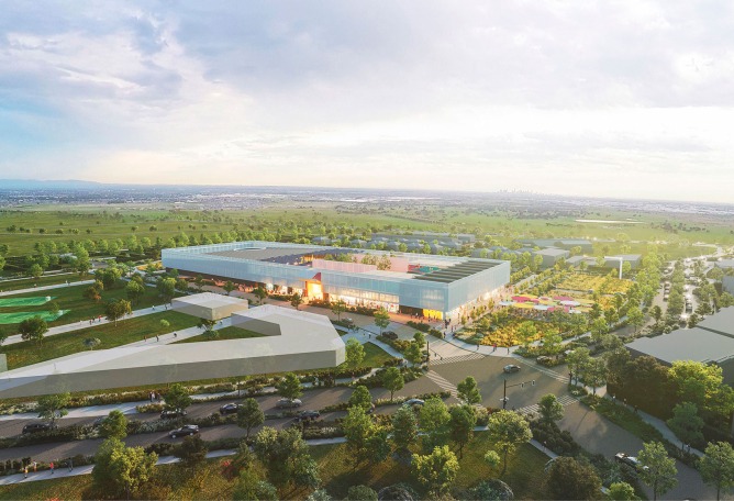
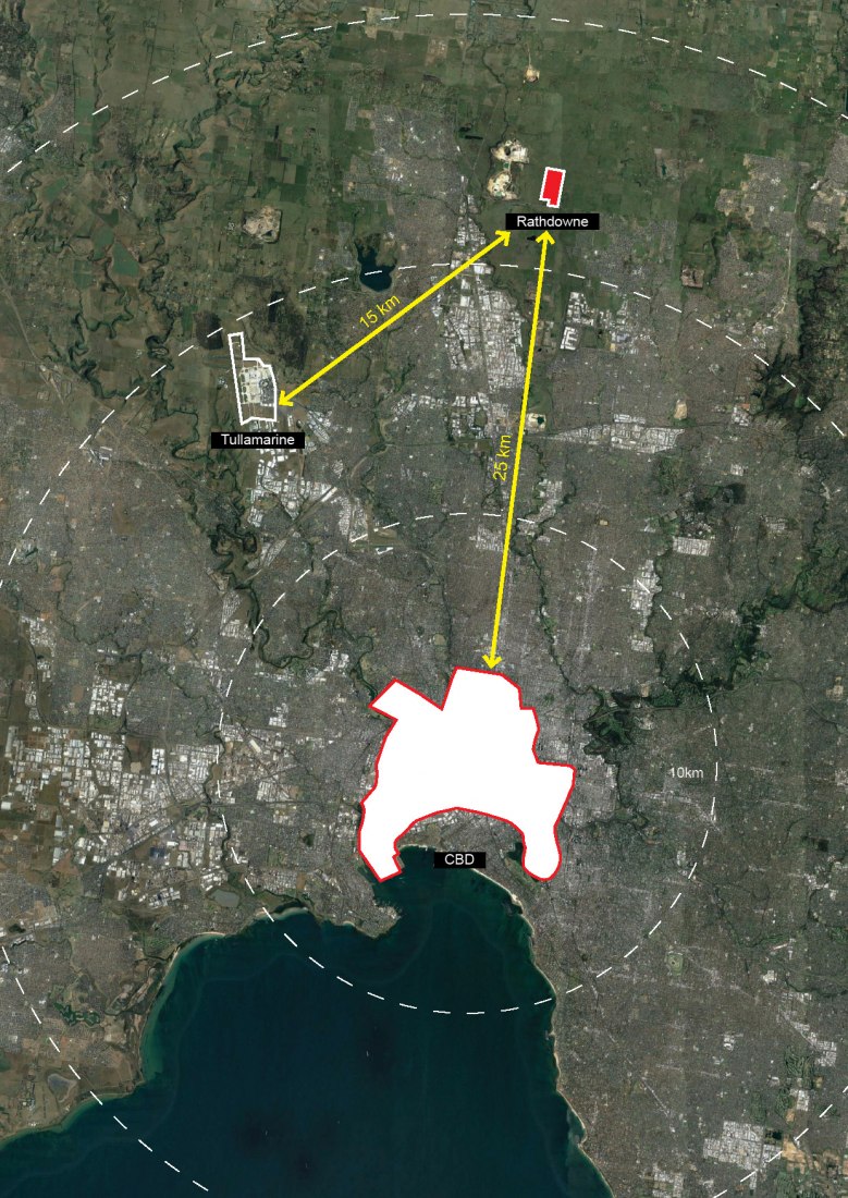
Offering a well-tempered environment and accessible by automobiles, suburban shopping centers are places for services and entertainment—destinations for consumption rather than social cohesion. Located in Wollert in the City of Whittlesea, 25 km north of Melbourne’s CBD and with a growing number of homes, the Wollert Neighbourhood Centre is a shopping centre conceived as social infrastructure: a place for communal experience where retail and social interaction weigh equal.
Existing community activity centres, separated from retail programs, are often underutilised. The 9,000-square-metre Wollert Neighbourhood Centre integrates community spaces—including a central public courtyard, amenity spaces, and childcare and education facilities—with the retail program. With an emphasis on health and wellbeing, the complex offers a range of diversified functions catering to commercial and community needs—a social condenser in the area to serve people across sections of society.
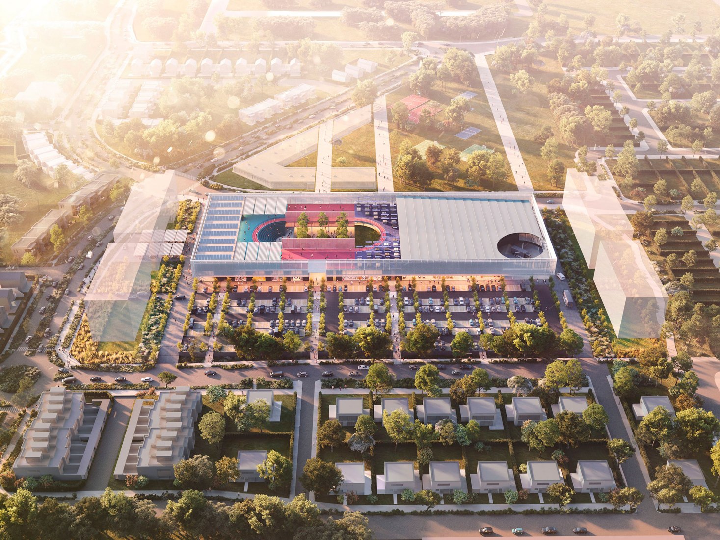
At the centre of the utilitarian-shaped Wollert Neighbourhood Centre is a shaded courtyard with an amphitheater. This is a space for curated community events and daily activities, encouraging residents in Wollert and neighbouring suburbs to spend time in the Centre and engage with each other. An accessible roof offers extra areas for sports and education, and opens up possibilities for urban agriculture and energy saving initiatives. Spatial zones organised in vertical stripes house other amenity spaces, facilities for children, and well-being-focused retail offerings. Such spatial organisation, together with landscape design of the courtyard, evoke barcodes ubiquitous in retail.
Multiple entrances in the elongated façade—facing the streets and the central courtyard—allow access to the building’s public space and through the building. The carpark to the south is separated from the pedestrian-friendly northern façade, while offering clearly-defined routes connected to the centre’s entrances. This single-level carpark at ground level can also be used as an additional outdoor public amenity space. A public transportation connection point to the west connects the centre to the greater Melbourne area—a means to draw otherwise dispersed suburb residents to the centre designed as a civic landmark.
The Centre has been conceived as the heart of a potential masterplan with residential and commercial programs. The mixed-use area, connected to neighbouring suburbs, will offer a new living option typically unexplored by the suburban population.
